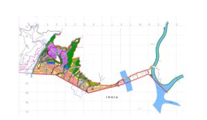
Name: Topographic Survey for the Basic Design Study on the Project for Reconstruction of Bridges, Phase 3, in the Kingdom of Bhutan
Name of the Client: Construction Project Consultants, Inc., Tokyo Japan
Project Description: Topographic Survey for the Basic Design Study on the Project for Reconstruction of Bridges, Phase 3, in the Kingdom of Bhutan
Scope of work:
• Collection of Hydraulic Data
• Calculation of Design Discharge and Linear Waterway
• Determination of borehole locations
Sub-Soil Exploration and Determination of Engineering Properties of Soil
• Detailed Description of the Actual Services Provided by your Firm
The Field Survey Works shall include the installation of Bench Marks and control survey by GPS and/or closed traverse with total station and direct leveling, topographic feature survey, collection of cross sectional data and data arrangements for digital mapping, control points description and etc.
Installation of temporary control points as the reference point for the topographic survey and collection of the cross sectional data
1. The temporary control points shall be set at least 100m intervals along the existing road. As an installation conditions, from every control point, all the road features between the adjacent control points on both sides as well as the adjacent control points itself, shall be visible for the purpose of accurate traverse, center line survey, topographical survey and etc.
2. Each control point shall be a driven concrete nail at asphalt pavement edge with a painted number or to be set in an undisturbed location near the road.

