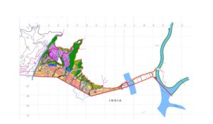
Name: Detail Topographic Survey for the Lungtenphu, Babessa, Simtokha & Changbandu LAP Area (total of 525 Acres) & 20km of New Water Line detail survey under the ADB 2258 BHU Project
Name of the Client: For DUDES, MooWHS under the lead partner STUP Consultants, Kolkata
Project Description: The project design & supervision in providing basic services of urban road, water supply & Sewerage works in the four LAPs. The project is funded through the ADB funding.
Scope of work:
General
• The main purpose of the Survey Works is to produce the topographic plan maps, road profiles, cross sections. These data shall be used to design the road, water supply & sewerage services for the Local Area Plans.
• The Works shall be executed in accordance with the terms, conditions and requirements of this Variation Order and under the supervision of the Client.
Working Area
The working areas are the four Local Areas of south Thimphu, namely, Changbangdu, Lungtenphu, Semtokha, Babessa & the water supply line from Megoipang to the four LAP Areas
Coordinates system and Datum level
Coordinates System and Datum Level shall be referred to that given by the Thimphu City Corporation (TCC).
Field survey works
The Field Survey Works shall include the picking up from established Bench Marks (of TCC) and control survey by GPS and/or closed traverse with total station and direct leveling, topographic feature survey, collection of cross sectional data and data arrangements for digital mapping, control points description and etc.
Control traverse survey by Total station
The control points may be surveyed by Total station and data logger shall be used and raw field data shall be submitted as a digital data along with the AutoCAD Map.
Vertical control survey by direct leveling
The leveling will be carried out by forward and backward round method, and shall be started from a known control point and/or be connected to another known point. Observation error between forward and backward or Closure error in connecting to a known point shall be less than 20√s mm, where s being the observation distances in km.
Numbering system and Codes for the surrounding terrain
Numbering of the control points and coding of the topographic features shall be systematically arranged, concise & clear.
Data arrangement, Mapping and Reporting
• All field observation data shall be submitted as a digital data on completion with brief note and necessary corrections on a printed paper.
• All survey results shall be compiled in AutoCAD or AutoCAD readable format (e.g. DWG or DXF format). The classification of the topographic data and the layers structure and arrangement of AutoCAD files shall be instructed by the Client.
• The fair drawings shall be printed. The sheet size of drawings to be submitted shall be “A0/A1” size in an international standard. All drawings shall be prepared based on the metric system and shall be produced in the international standards.
• All control points with name and all natural and artificial features such as buildings, drainage, bridges, road/footpath, vegetation boundary, river/stream and etc shall be indicated on the topographic maps. Also, the boring points with their ground level elevation shall be indicated on the topographic maps.
• Contour lines shall be drawn in 1m intervals. Moreover, the spot elevation shall be indicated with its reference point on the topographic maps.
The consultant shall submit to the Client the following products:
1) Raw field data (in LISCAD)
2) Drawings (both hardcopy as well as softcopy)

